Farsight APP real-time 2D/3D map modeling is suitable for disaster exploration, military, police and security, etc. It can maximize effectiveness, reduce time, and provide immediate rescue when a disaster occurs.

Rescue personnel at disaster sites face unique challenges, namely "the inability to grasp the comprehensive disaster situation in a timely manner." Although disaster information is constantly updated, the command center cannot quickly establish an effective rescue plan with limited information. This slow disaster analysis , is unable to match the fast-paced rescue environment of frontline personnel.
The American Farsight app software installed on mobile phones emphasizes artificial intelligence (AI) and edge fast computing technology. When paired with drones, it can provide intuitive and fast intelligence on the edge of disasters. Unlike any other commercial or government off-the-shelf solutions on the market, the Farsight app software completes real-time 2D map and 3D map modeling on smartphones, and provides: line of sight analysis, AI route planning, helicopter landing zones, and airdrop material delivery. Zone, vertical measurement and other functions.
芒種

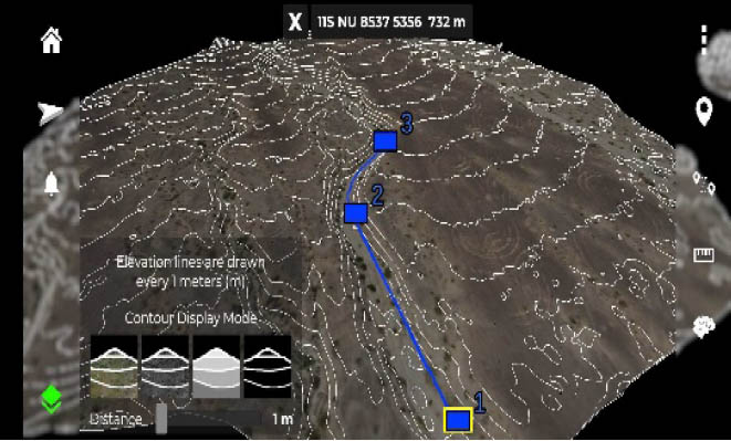
Digital elevation map (DEM) to quickly find favorable terrain and features

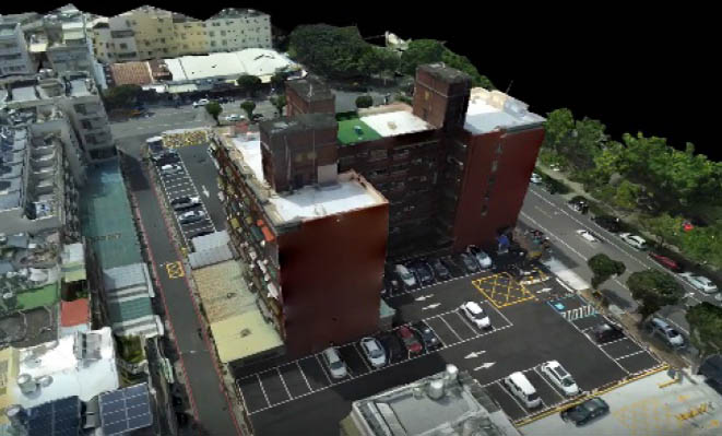
Quickly create accurate 3D map models on your mobile phone

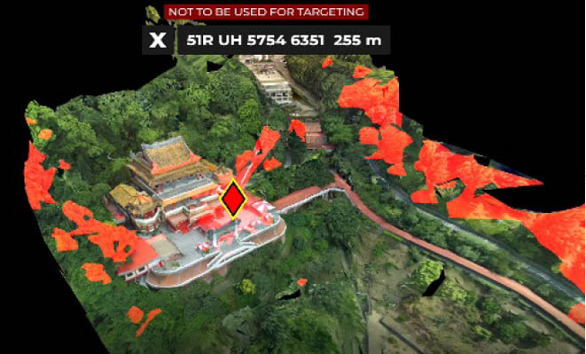
The sight range (red zone) of the location of the person being searched (red diamond)

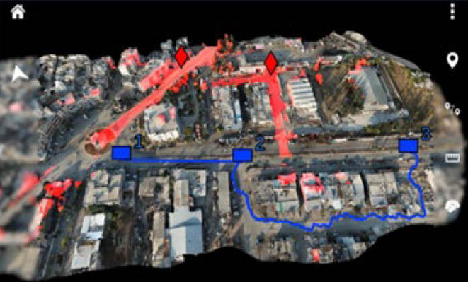
AI automatically plans appropriate routes based on terrain/sight analysis, etc.

Farsight

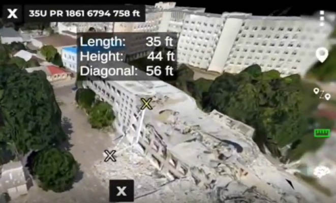
AI measurement tool to determine building/obstacle structural dimensions

Farsight

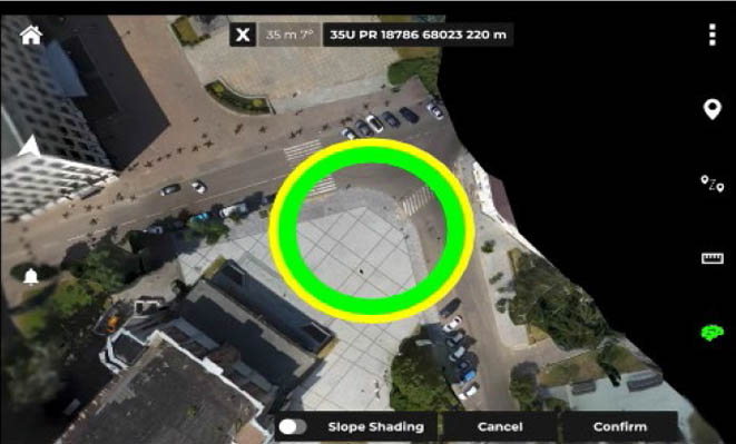
AI plans safe landing position for helicopters (such as Black Hawk)

Farsight App Features

Near real-time mapping

Special search teams equipped with small unmanned aerial systems and mobile devices can instantly activate and access the optimal search coverage required, eliminating dependence on large cloud platforms and increasing their awareness. Accurate 3D mapping enables operators to understand their environment to enhance their mobility.

Route planning

As the small drone flies, it begins transmitting map data to the operator. Once the 3D map is complete, operators can place routes, line of sight analysis and other maneuvering mechanics onto the 3D model and then import it onto the ATAK platform.

ATAK streaming workflow

Designed to keep evidence operators active without having to look down at data, Farsight and ATAK stream, record and process data generated by a variety of drone systems, ground controllers and software integrations, reducing the need to create intelligence in the field. The time required for the product.

Line of sight analysis

Farsight’s AI Line of Sight (LOS) analysis quickly creates value for operators. Whether using line of sight analysis to confirm the line of sight of a person being searched or specifically diverting plans, Farsight allows discrete teams to be more creative in their evidence collection advantage.

HLZ survey (helicopter landing point)

Farsight Helicopter Landing Site Surveys take into account aircraft type and airframe functional characteristics to recommend helicopter landing site locations and are transmitted to air assets in real time via ATAK.

Vertical measurement

When viewing a 3D model, operators can use Farsight's vertical measurement tools to conduct in-depth analysis of building heights, road lengths, etc. Operators can quickly develop mission plans with an understanding of their environment.
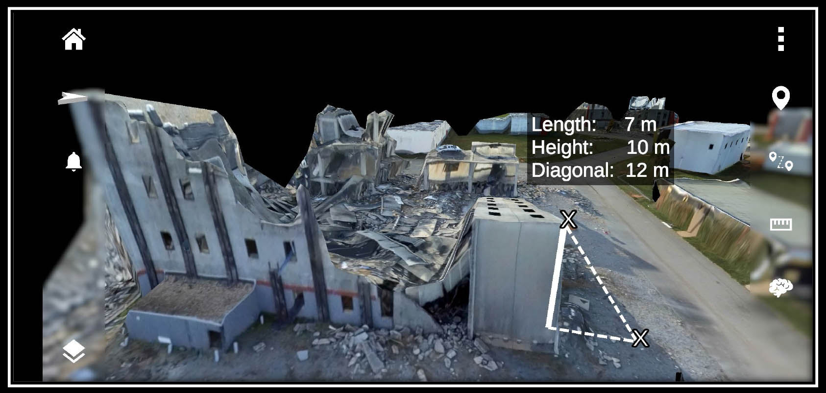
Measuring tools:

You can measure obstacles on your mobile phone and assist in disaster relief. The personnel quickly formulated and executed search and rescue and rescue tasks.

Quick

      Quickly completed in 10 minutes
      2D real-time map
      3D near real-time map
      AI sight analysis/path planning
Farsight

Easy to use

      The operation of the APP is simple and intuitive. Even in complex and stressful situations, you can feel at ease, just like eating a piece of cake
Farsight

Lightweight and powerful

      It can be operated on mobile phones and tablets, and you can instantly analyze and obtain results on site, and quickly share accurate 3D model information